
What's new in Skippy Scout version 3
The key new features
Weed maps and spot-spray grids
- Full field maps from Spheres in minutes
- Custom weed and variability maps
- Zones extracted, auto scouting/drone ground-truth
- Spray grids auto-matched to your tramlines and sized to your sprayer
Improved Spheres
- Faster construction - now less than 5 minutes
- Higher resolution
- More accurate
- New layers
Improved reports
- New layout
- Interactive
- Multiple flights merged into one report
- Spheres maps included
New Drone & Dock options, plus pre-flight checks
- Upload images from any drone
- DJI Dock and FH2 integrations
- Automated pre-flight checks for airspace, hazards and weather
- Automated Risk Assessment forms
Control Center
- New web and mobile interface
- Import new fields and layers easily from anywhere
- Export data and reports in multiple formats
- Monitor flight status
Cereals establishment analysis
- Overall establishment status
- Row occupancy and gap detection
- Row width and direction
- Weed detection (beta)
One flight, then the whole job
From the 360° field view to crop zones, a field report and a variable-rate file, in about 80 seconds.
Skippy Scout version 3 · Part 1
Spray the weeds, not the whole field: how one drone flight cut herbicide use by about 64%
One 17.6 ha oilseed rape field, one flight, and a weed map that showed where to spray. Here is what the agronomist found, and what it saved.
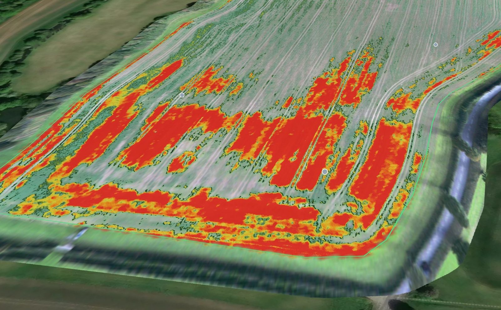
The weed map for the field. Red and orange mark the weeds. One flight, one map.
In autumn 2023 an agronomist tried the other way on a field of establishing oilseed rape: fly the field, map the weeds, and spray only where they are.
The field in numbers
- 17.61 haof oilseed rape
- 6.35 haof grass weeds found
- 11.26 hathat did not need spraying
- About 64%less herbicide than blanket spraying
The weeds covered about 36% of the field, so spraying only them meant using about 36% of the product a blanket spray would have taken.
Step 1: Fly
The field boundary goes into the Skippy Scout app. The agronomist picked the scout points, pressed Fly now, and the drone did the rest. It photographed every scout point and captured a 360 view of the whole field. The flight takes about 5 minutes: about a minute for the 360 view, and under 4 minutes for six scout points.
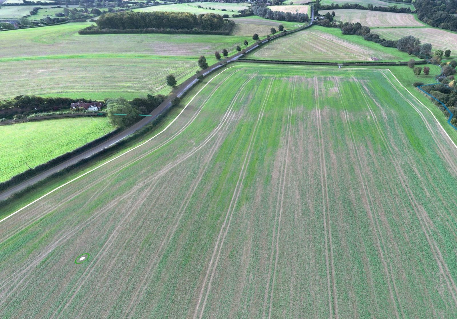
The 360 view of the field, taken on the same flight.
Step 2: Measure
The drone’s images become a map of the whole field, and the weed layer shows where the weeds are. On this field the weeds were concentrated in patches across the lower half and along the headland, 6.35 ha in all. The upper part of the field was largely clear.
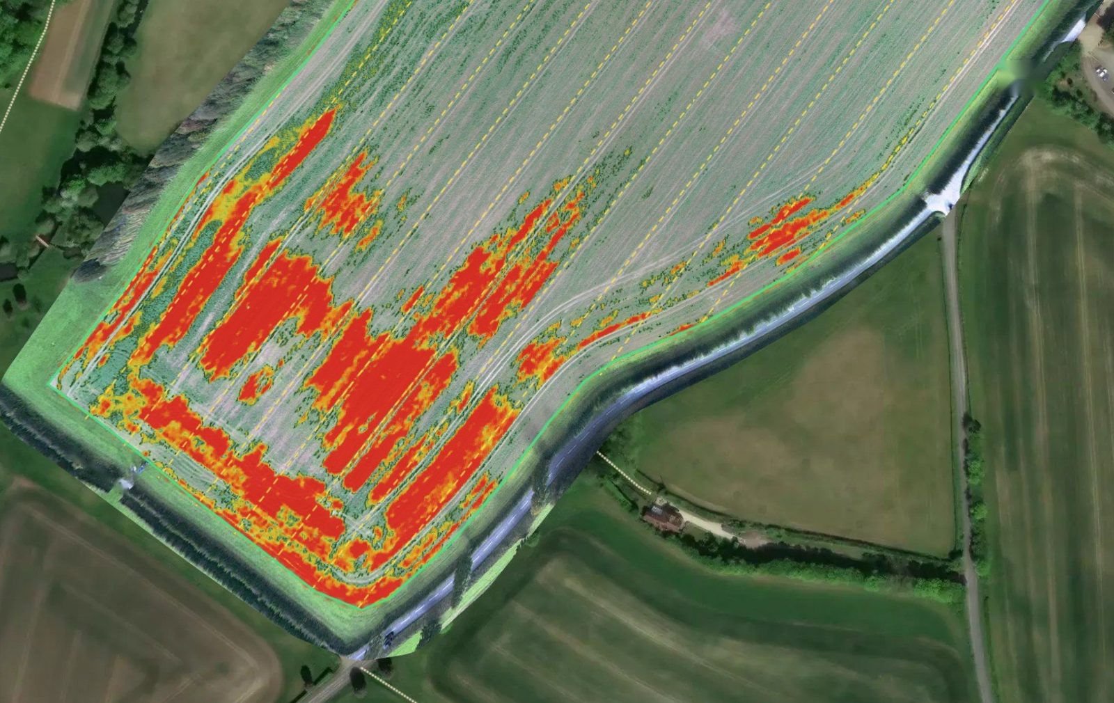
The weed map. Yellow is a faint weed signal, red is strong.
Step 3: Check, without walking the field
Scout points are added to the map, and the drone visits each one automatically, capturing very high-resolution photos. That is far faster than walking out to ground-truth the map, and it means you never have to walk the field. Many services stop at the map. Skippy goes further: the drone checks it for you.
This is the part that makes spot spraying something you can trust. Every scout point shows the photo next to what the AI found: crop in green, weeds in red, bare ground in black. You can check any patch before you spray, and the agronomist could make decisions while still standing in the field.
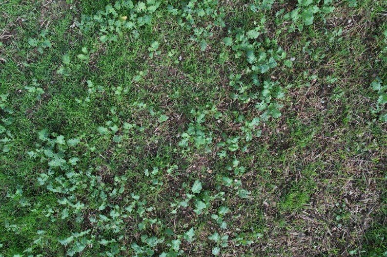
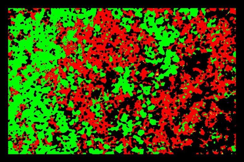
A scout point with weeds | What Skippy found: weeds 32% of the ground
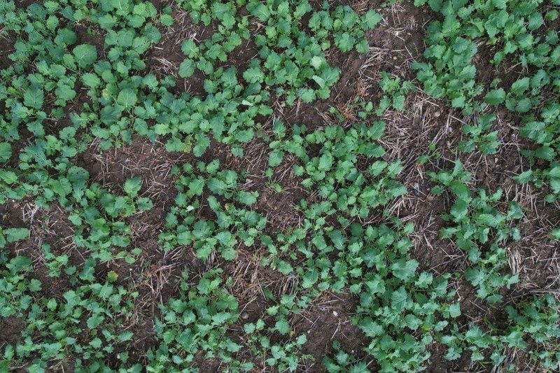
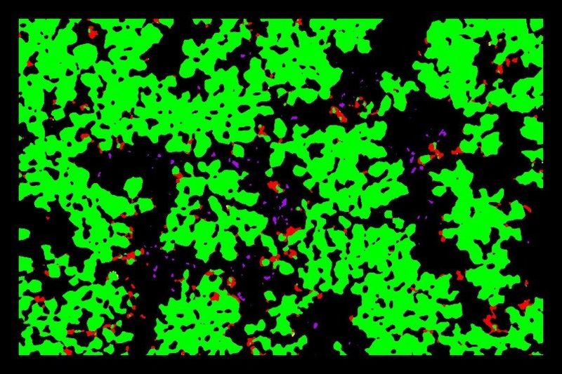
A scout point without weeds | What Skippy found: weeds 2% of the ground
Crop only, by design. The weeds are measured separately from the crop, so the figures you get describe the crop alone. Satellite measurements generally cannot tell a weed from the crop: they count both, so a weedy field reads better than it is.
Step 4: Spray
The weed targets become a spray grid, sized to your sprayer. In this example the cells are 12 m wide on a 24 m tramline spacing, and the grid is squared to the tramlines, so the sprayer switches on over the weeds. Export it as ISOXML, Shapefile or GeoJSON for your sprayer’s terminal. From the end of the upload, the spray file is ready in about 15 minutes.
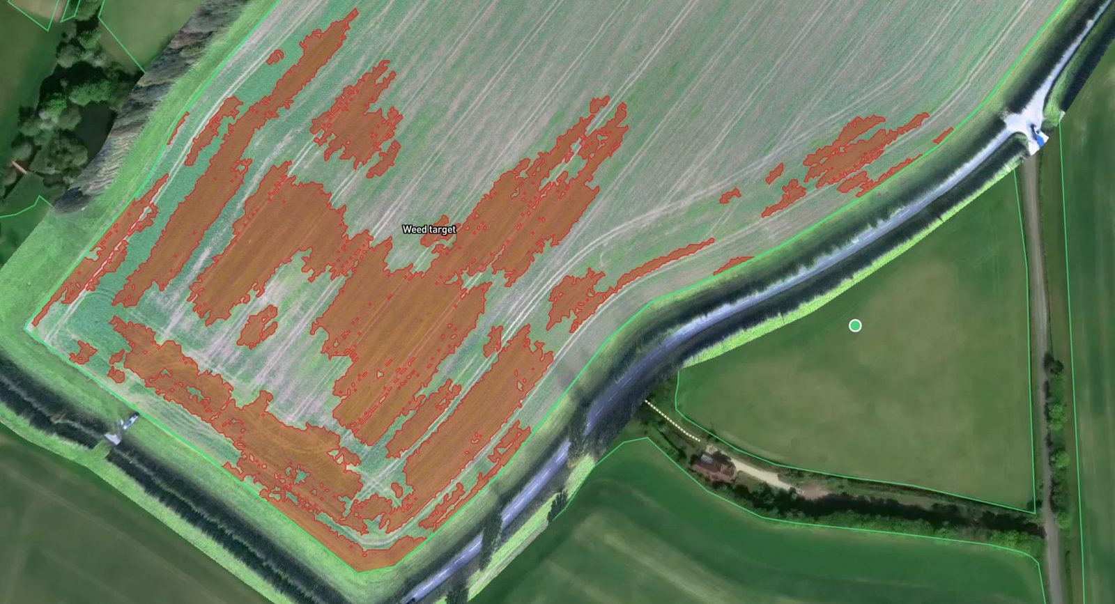
The weed targets, shown in red.
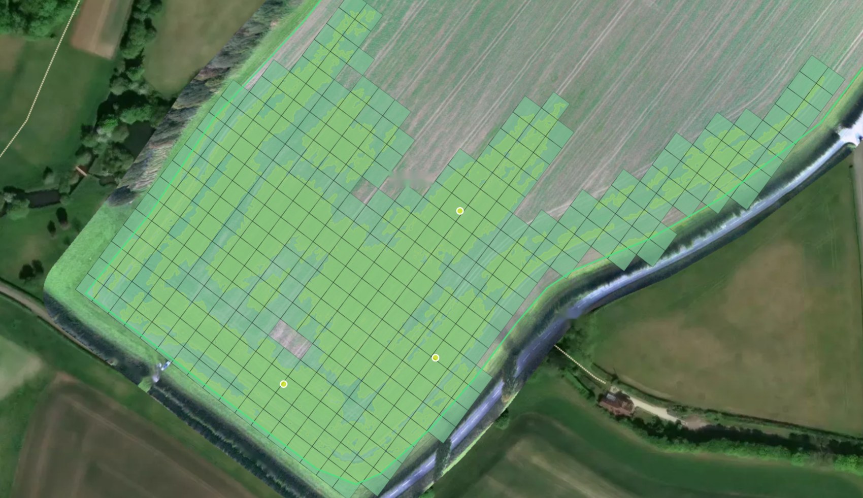
The spray grid built from them: 12 m cells on a 24 m tramline spacing. Cells are whole squares, so a cell covers a little more than the weeds in it.
The result
- About 64% less herbicide than blanket spraying.
- £213 saved on the first spray, at 2026 prices: clethodim at about £19/ha, applied to 6.35 ha instead of 17.61 ha.
- A further £388 expected on a follow-up spray with propyzamide, at about £34/ha.
- £601 of potential saving on one field, about £34 per ha across the whole field.
There is an environmental benefit too. Propyzamide works best when soil temperatures are below 10°C, which usually means applying in late November or December, when rainfall is higher and the risk of soil run-off is greater. Applying it only where it is needed means less product in the field, and less that can reach surface water.
Then check it worked
Four weeks after spraying, the same scout point was flown again. Weed cover was down and crop cover was up: the follow-up flight showed that the spray was effective.
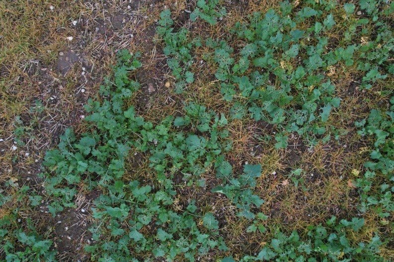
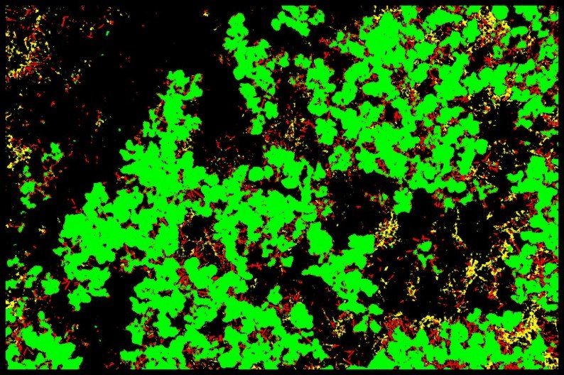
1 November: four weeks after spraying.
What this means for your fields
Savings depend on your field, your weeds and your products. This field had weeds in patches, which is where targeting pays. If your weeds are everywhere, the map will show that too, and you will spray the lot knowing you had to.
Does it identify blackgrass?
Skippy maps weed pressure and shows you the photos, so you can see exactly what it found. Deciding what the weed is, and whether to spray it, stays with you and your agronomist.
Which sprayers does it work with?
The spray plan exports as ISOXML, Shapefile or GeoJSON. Tell us which terminal you run and we will check the file with you before you rely on it.
How long does it take?
About 15 minutes from the end of the upload to a spray file, measured on recent flights, plus the flight itself, which takes about 5 minutes.