
Skippy Scout version 3
Automated scouting by drone, from flight to answer in minutes
Weed maps and spot-spray files, cereal establishment, 360° Spheres, reports, docks and a new Control Center.
Who we are
Built by farmers who know drones
Drone Ag is an agricultural technology company in Northumberland, founded by arable farmer Jack Wrangham. We build Skippy Scout on our own farm, so it has to work in a real field, on a real day.
What Skippy Scout does
See the whole field, check the detail, act the same day
1. Fly
Load the boundary, pick scout points, press Fly. About five minutes in the air.
2. Measure
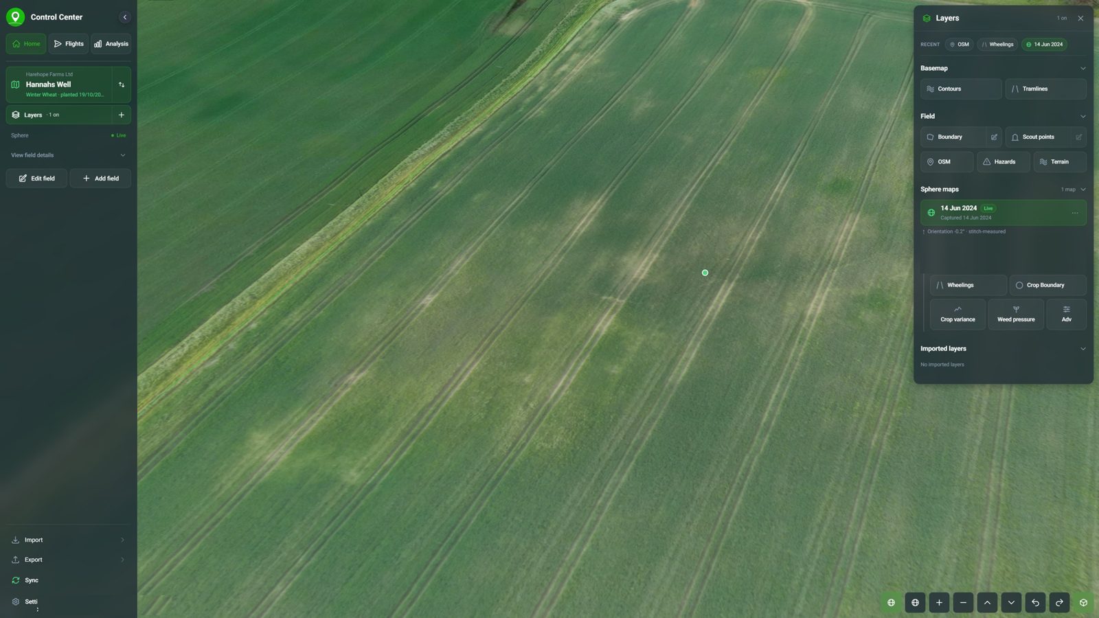
One flight becomes a 360° Sphere and maps of the whole field: weeds, variability, zones.
3. Check
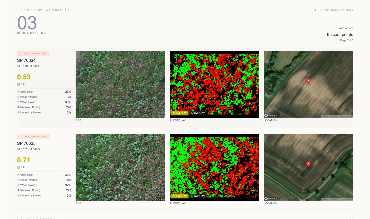
The drone visits each scout point for very high-resolution photos, so you check the map without walking.
4. Act
Spray files, variable-rate files and reports, ready in minutes for the sprayer or the agronomist.
One flight
Five minutes in the air
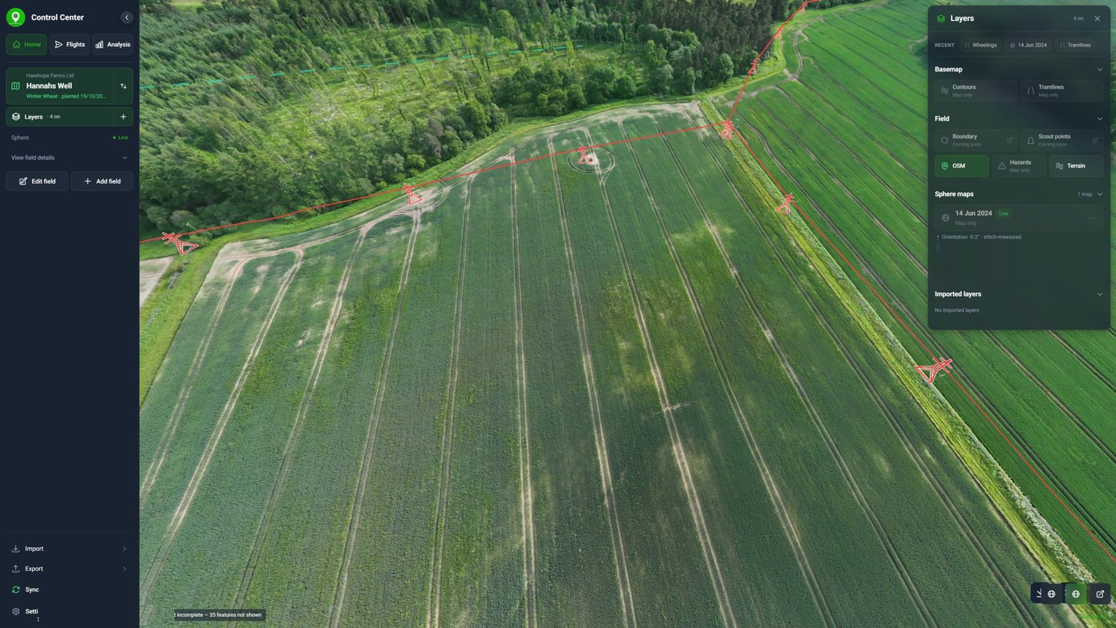
- About 1 min for the 360° Sphere of the whole field
- Under 4 min for six scout points, photographed up close
- Under 5 min to build the Sphere after upload
Weed maps and spot-spray grids
15 minutes
From the end of the upload to a weed map and a spray file sized to your sprayer. The same day you fly, not days later.
Weed maps
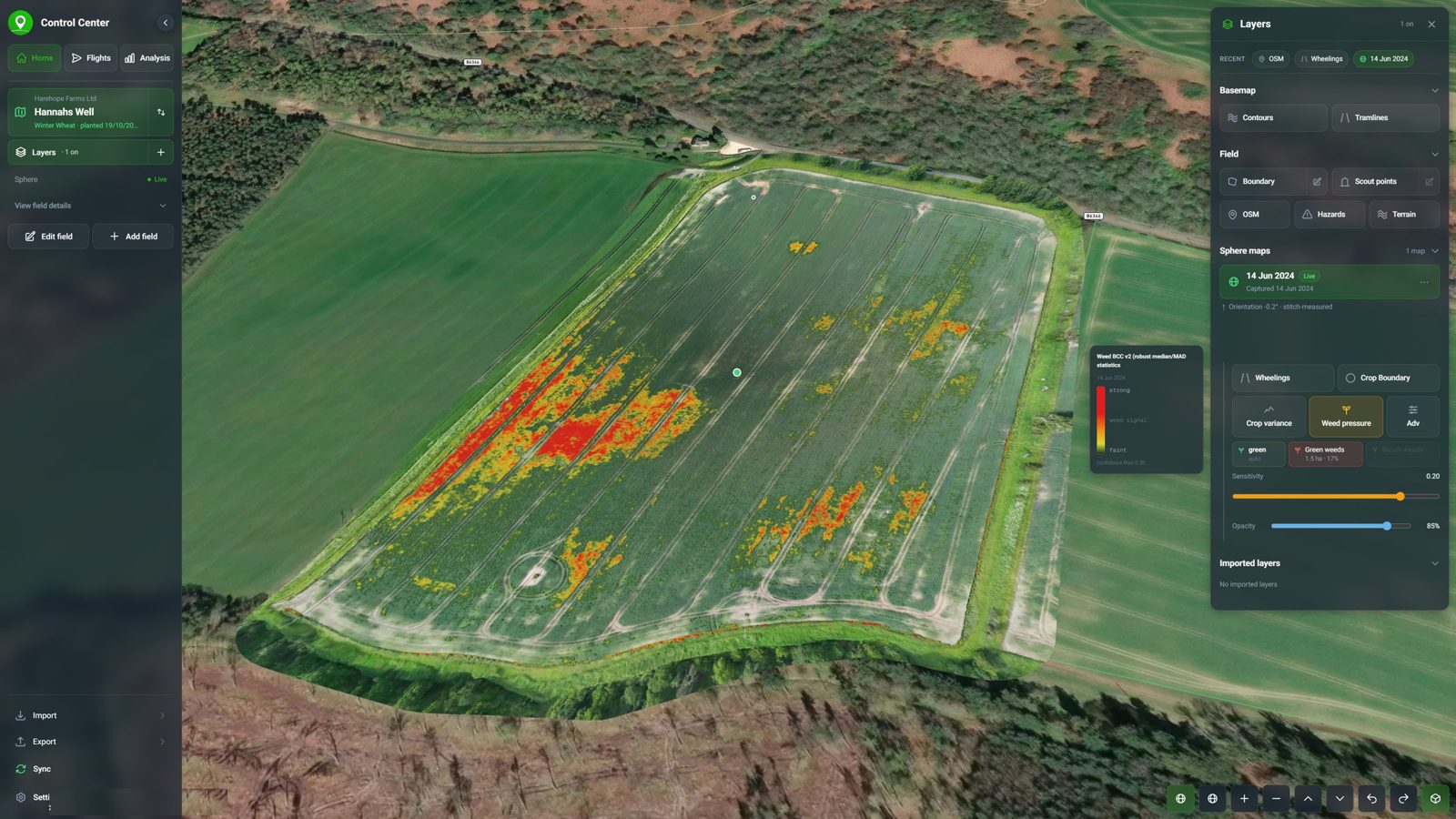
The whole field, from one flight
- Full-field maps from the Sphere in minutes
- Custom weed and variability maps
- Zones extracted automatically
- Weeds measured separately from the crop
Automatic scouting
Check the map from the air, not on foot
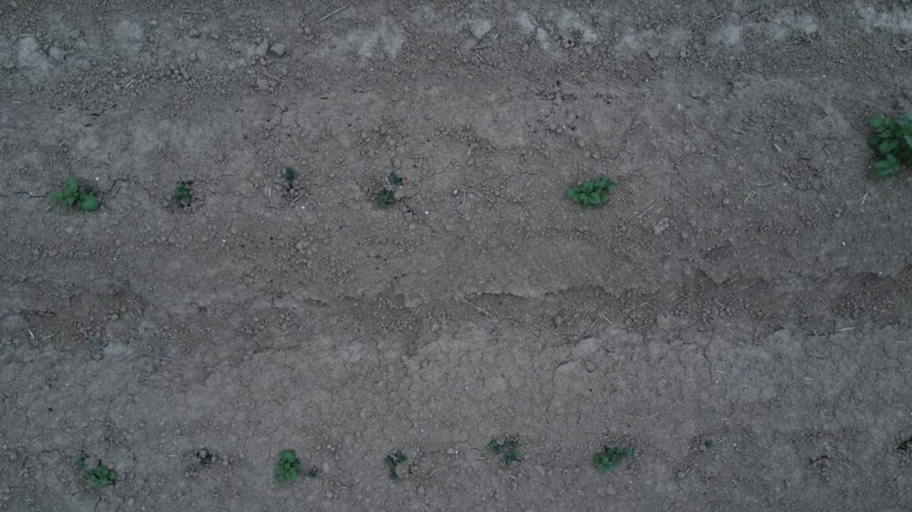
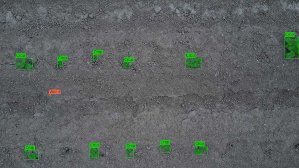
Scout points go on the map and the drone visits each one by itself, taking very high-resolution photos.
Many services stop at the map. Skippy checks it for you, so you never walk the field to ground-truth it.
Spot-spray grids
A spray plan that fits the sprayer
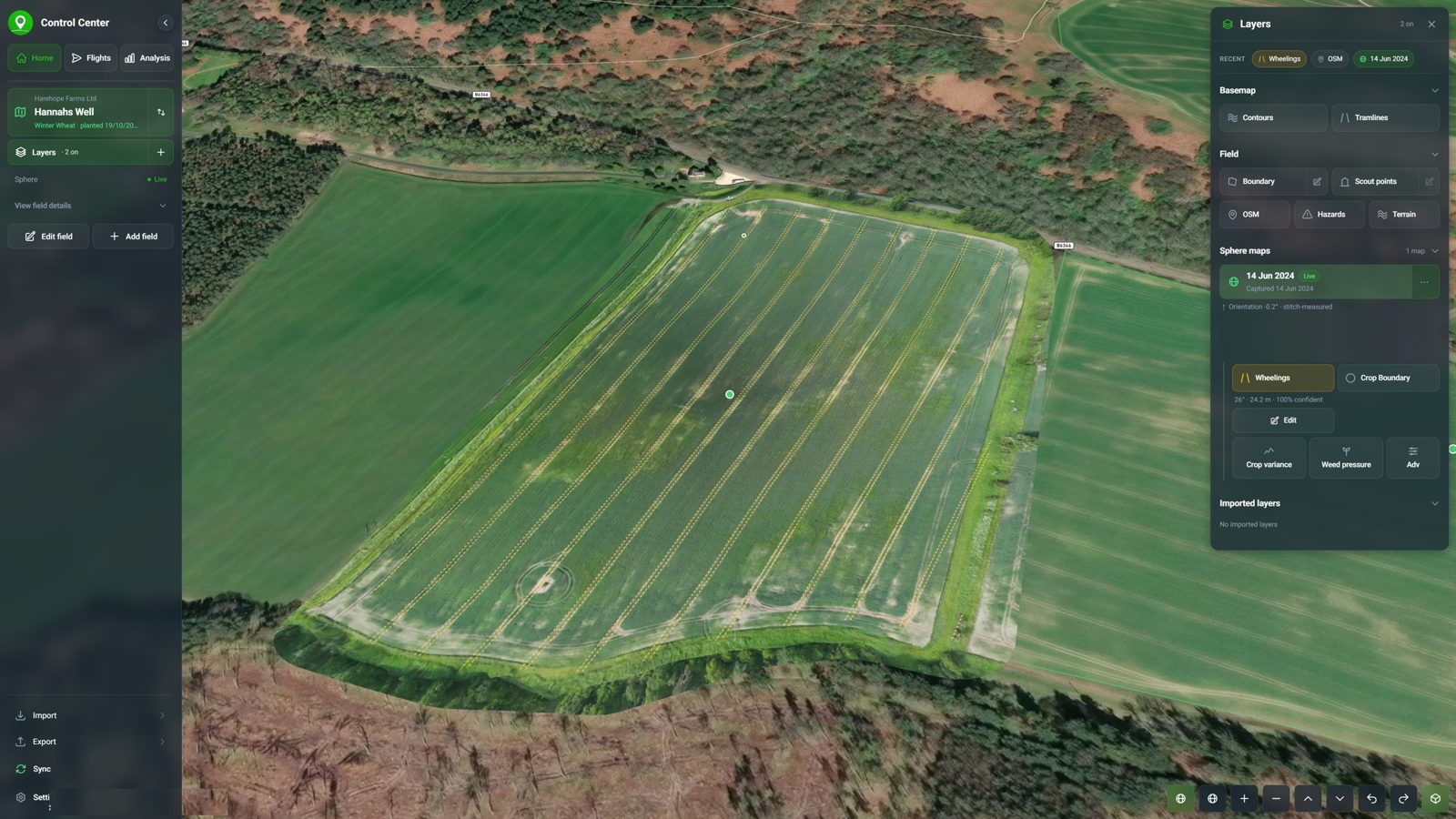
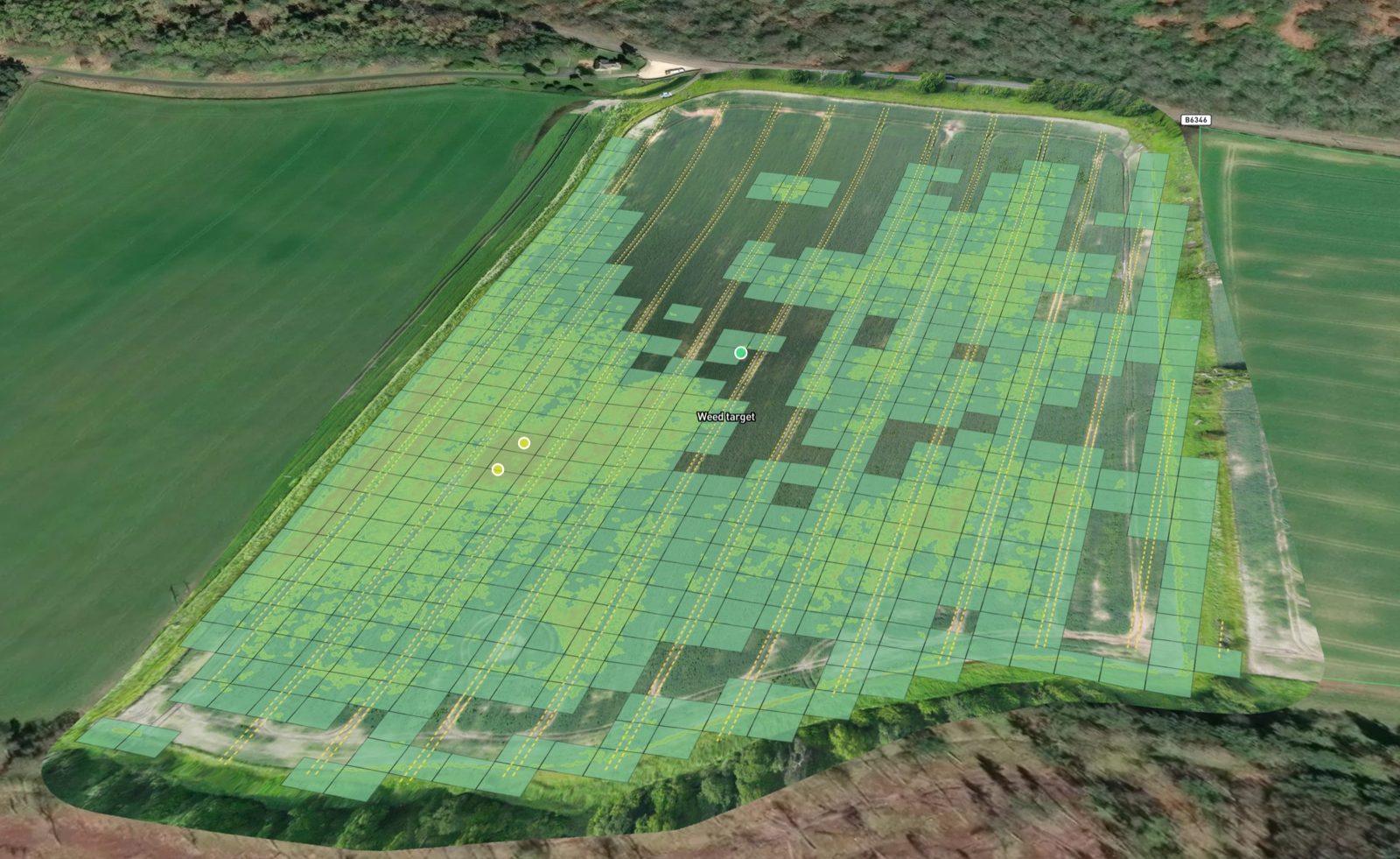
Exports as ISOXML, Shapefile or GeoJSON for the sprayer’s terminal, about 15 minutes after upload.
What it could save
Where weeds grow in patches, spray only the patches
| Spray grid covers | Herbicide saved | Saving per 100 ha |
|---|---|---|
| 20% of the field (tight patches) | about 80% | about £4,200 |
| 35% of the field (larger patches) | about 65% | about £3,400 |
| 50% of the field | about half | about £2,650 |
Against Skippy Enterprise Pro from £3.50 per ha a year. See a field example →
Oilseed rape, clethodim at about £19/ha then propyzamide at about £34/ha (about £53/ha, 2026 UK prices). Savings depend on the field, the weeds and the products.
Cereal establishment
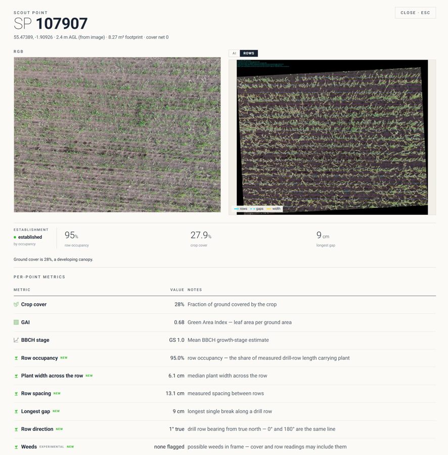
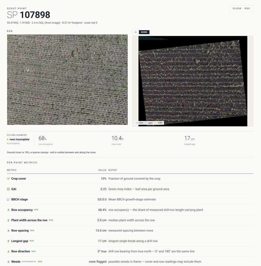
How the rows came up
- Overall establishment status
- Row occupancy and gaps
- Row width and direction
- Weed detection (beta)
Early access
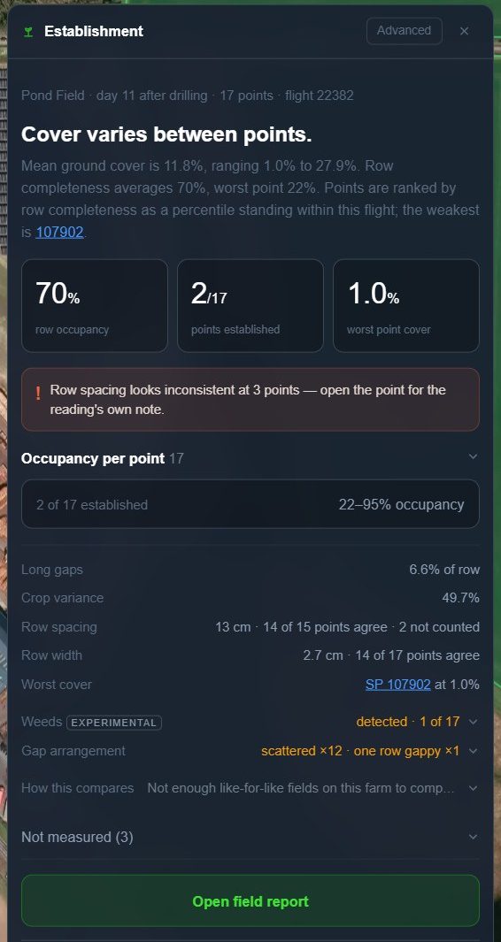
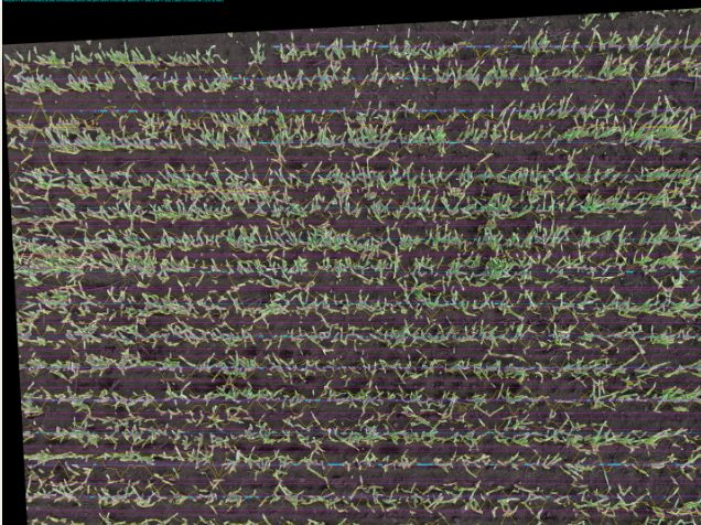
Cereal establishment
Every scout point, measured row by row
Improved Spheres
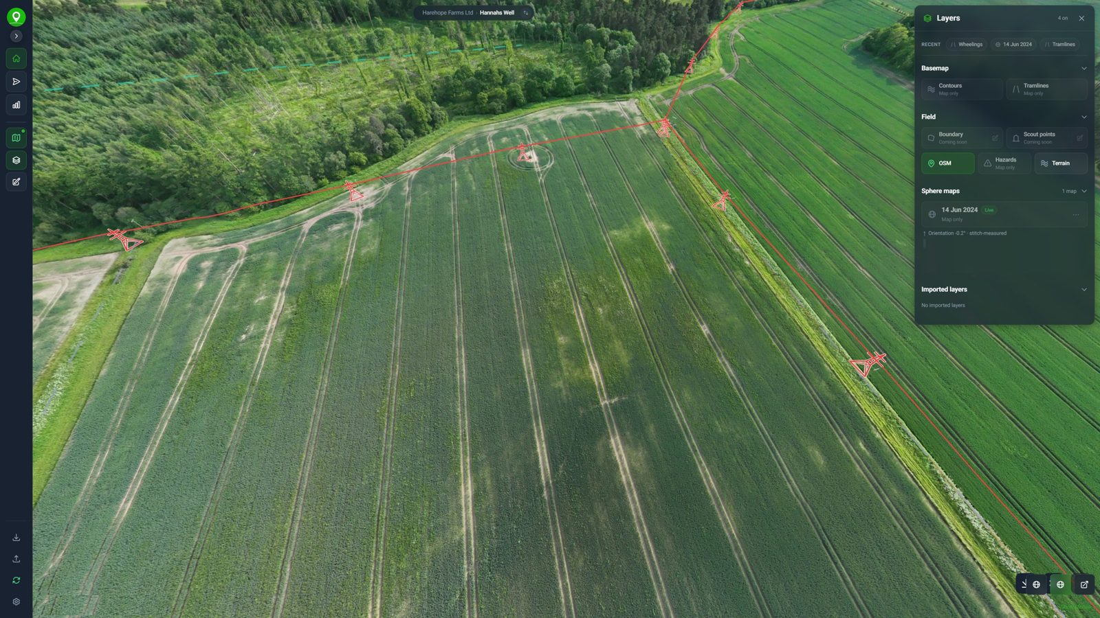
The field in 360°, in minutes
- Built in under 5 minutes
- Higher resolution
- More accurate
- New layers, hazards marked
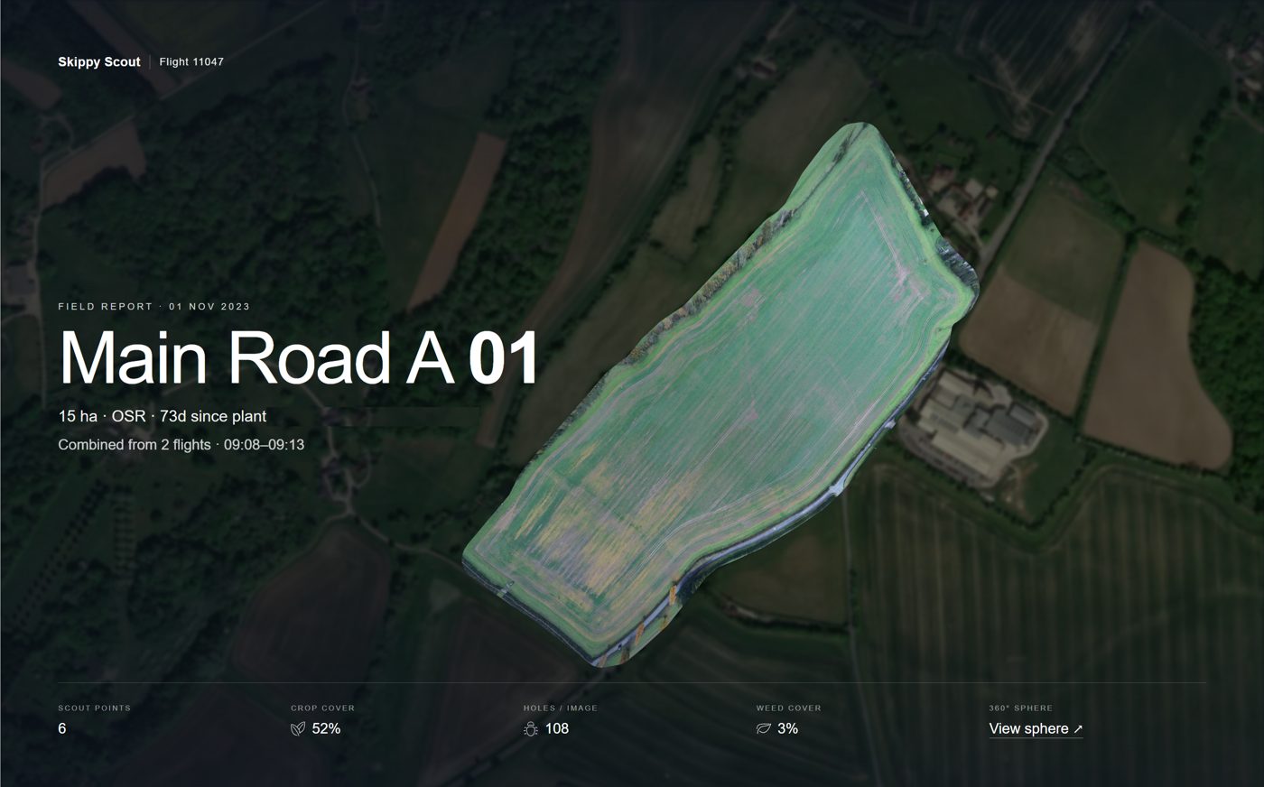
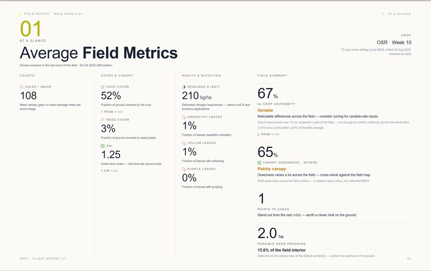
Improved reports
One report for the whole job
Drones, docks and pre-flight checks
Your drone, or one that flies itself
Any drone
Upload images from any drone.
Docks
DJI Dock and FlightHub 2 integration, for remote automated flights.
Pre-flight checks
Airspace, hazards and weather, checked automatically.
Risk assessments
Risk assessment forms filled in automatically.
Control Center
Everything in one place
- New web and mobile interface
- Import fields and layers from anywhere
- Export data and reports in many formats
- Monitor flight status live
Enterprise
Skippy inside your own platform
White label
Skippy under your own brand: your name, logo and colours on the app, the Control Center and the reports your customers see.
API access
Fields, flights, maps and measurements available to your own systems, so the data flows where your team already works.
Custom integration
Connected to the other software platforms you use: farm management, agronomy and trial systems, dashboards.
All available on a custom quote. Talk to us →
Get started
Try it on one field
Fly one field and we will run the analysis and show you the result.